

Main Points In Hindi (मुख्य बातें – हिंदी में)
यहाँ पर चक्रवातीय तूफान ‘फेंगल’ के बारे में मुख्य बिंदु प्रस्तुत किए गए हैं:
-
चक्रवात का संभावित निर्माण: ‘फेंगल’ नामक चक्रवातीय तूफान अगले दो दिनों में विकसित हो सकता है, जिससे इसका प्रभाव 26 नवंबर (मंगलवार) को देखा जा सकता है। बंगाल की खाड़ी में एक निम्न दबाव क्षेत्र बन चुका है, जो पश्चिम से उत्तर-पश्चिम दिशा में आगे बढ़ रहा है।
-
भौगोलिक दिशा और प्रभाव: यह तूफान संभवतः तमिलनाडु की ओर बढ़ेगा और फिर श्रीलंका की तरफ जाएगा। हालांकि, इसके भूमि पार करने से पहले कमजोर होने की संभावना है। ओडिशा पर इसका कोई महत्वपूर्ण प्रभाव नहीं होगा।
-
IMD की चेतावनी: भारतीय मौसम विभाग (IMD) ने पूर्वानुमान दिया है कि यह प्रणाली अगले 24 घंटों में गहरी अवसादित प्रणाली में बदल सकती है, जो बाद में चक्रवातीय तूफान में तब्दील हो सकता है।
-
विकास पर अंतरराष्ट्रीय दृष्टिकोण: अंतरराष्ट्रीय मौसम पूर्वानुमानकर्ता जैसन निकोल्स ने बताया है कि यदि यह प्रणाली चक्रवातीय परिसरों में बदलती है, तो इसका नाम ‘फेंगल’ होगा, जो सऊदी अरब द्वारा दिया गया है।
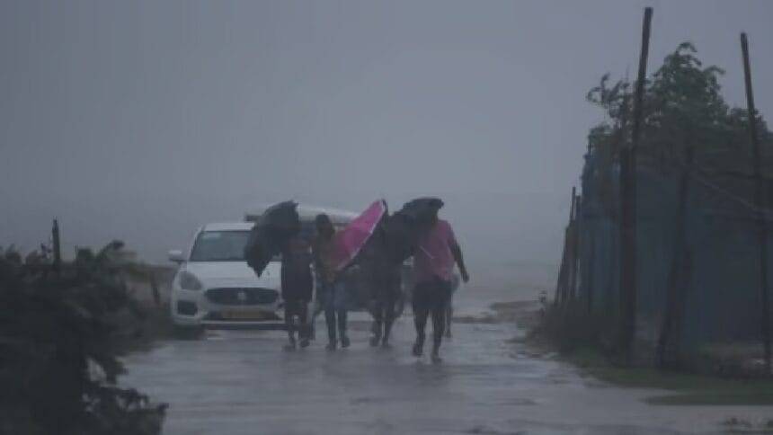
- ओडिशा में हल्की वर्षा की संभावना: सभी पूर्वानुमानों के अनुसार, संभावित चक्रवात ‘फेंगल’ ओडिशा में भारी प्रभाव नहीं डालेगा, लेकिन ओडिशा के तटीय क्षेत्रों में हल्की वर्षा हो सकती है।
Main Points In English(मुख्य बातें – अंग्रेज़ी में)
Here are the main points regarding Cyclonic Storm Fengal:

-
Storm Formation and Forecast: A low-pressure area has developed in the Bay of Bengal, which is expected to intensify and could become Cyclonic Storm Fengal, potentially making landfall in the next two days, specifically around November 26th.
-
Path and Impact: The storm is projected to move from west to north-west, threatening coastal areas of Tamil Nadu and moving towards Sri Lanka. It is anticipated to weaken before making landfall.
-
Minimal Impact on Odisha: Weather forecasts indicate that Cyclonic Storm Fengal will likely not significantly affect Odisha, although light rain and cloudy conditions may occur in coastal regions.
-
Monitoring by Meteorological Departments: The India Meteorological Department (IMD) is monitoring the situation and has provided warnings that further intensification into a deep depression, which may then develop into a cyclonic storm, is possible within the next 24 hours.
- International Predictions: International weather forecasters, including Jason Nicholls, suggest that if the storm becomes a cyclonic circulation, it will be named Fengal, based on the naming convention from Saudi Arabia.
Complete News In Hindi(पूरी खबर – हिंदी में)
चक्रवातीय तूफान फेंगल अगले दो दिनों में भूमि पर आ सकता है। इसका प्रभाव मंगलवार, 26 नवंबर को दिख सकता है। इससे पहले, बंगाल की खाड़ी में एक निम्न दबाव का क्षेत्र बन गया है, जो दक्षिण-पूर्व दिशा में स्थित है। यह अगले दो दिनों में तटवर्ती क्षेत्रों में दस्तक दे सकता है। यह पश्चिम से उत्तर-पश्चिम दिशा की ओर बढ़ रहा है। अगले दो दिनों में इसके और शक्तिशाली होने की संभावना है और यह चक्रवातीय तूफान में बदल सकता है। विदेशी एजेंसियों ने इसके बारे में पहले ही चेतावनी दी है।
अंतरराष्ट्रीय मौसम पूर्वानुमानकर्ता जेसन निकोल्स ने इस चक्रवात की दिशा की भविष्यवाणी की है। यदि यह चक्रवातीय हलचल का रूप लेता है, तो इसका नाम ‘फेंगल’ होगा, जिसे सऊदी अरब द्वारा दिया गया है।
चक्रवातीय तूफान का खतरा
यह चक्रवातीय तूफान तमिलनाडु की ओर बढ़ेगा और फिर श्रीलंका की ओर जाएगा। हालांकि, इसके भूमि पर पहुंचने से पहले कमज़ोर होने की संभावना है। संभावित चक्रवात ‘फंगल’ का ओडिशा पर कोई प्रभाव नहीं पड़ेगा, जैसा कि मौसम पूर्वानुमान में कहा गया है।
इसके अलावा पढ़ें: ओडिशा-बंगाल सहित कई राज्यों में बारिश की संभावना, दिल्ली-एनसीआर में बढ़ा प्रदूषण, अन्य राज्यों की स्थिति जानें
भारत मौसम विज्ञान विभाग (IMD) ने इस तूफान के बारे में जानकारी दी है। इसके आधिकारिक बयान के अनुसार, यह प्रणाली उत्तर-पश्चिम दिशा में बढ़ने की संभावना है और अगले 24 घंटों में गहरी Depression में बदल सकती है। एक गहरी Depression चक्रवातीय तूफान में बदल सकती है। इसके बाद, नाम ‘फेंगल’ हो जाएगा, जैसा कि सऊदी अरब द्वारा सुझाया गया है।
IMD ने दी जानकारी
हालांकि, IMD के पहले के पूर्वानुमान ने दिखाया कि गहरी Depression श्रीलंका की ओर बढ़ेगी और देश के उत्तरी हिस्सों पर प्रभाव डालेगी, फिर तटीय तमिलनाडु के उत्तर तट के पास dissipate हो जाएगी। अभी तक IMD ने चक्रवातीय हलचल की चेतावनी नहीं दी है। हालांकि, अन्य वैश्विक मॉडल ने यह सुझाव दिया है कि गहरी Depression सप्ताह के अंत तक एक चक्रवातीय तूफान में बदल सकती है और संभवतः दक्षिण भारत में भूमि पर पहुंच सकती है।
इसके अलावा पढ़ें: यूपी मौसम: अगले 3 दिनों के लिए बारिश और तेज़ हवाओं की चेतावनी, मौसम अपडेट जानें
सुप्रसिद्ध यह है कि सभी मॉडल ने भविष्यवाणी की थी कि संभावित चक्रवात फंगल या तूफान की लहर ओडिशा में भूमि पर नहीं पहुंचेगा, लेकिन इसकी तटों पर बारिश हो सकती है। वर्तमान स्थिति के अनुसार, गहरी Depression के कारण ओडिशा के तटीय क्षेत्रों, जिसमें भुवनेश्वर भी शामिल है, में बादल छाए रह सकते हैं और हल्की बारिश हो सकती है।
Complete News In English(पूरी खबर – अंग्रेज़ी में)
Cyclonic storm Fengal may make landfall in the next two days. It can show its effect on Tuesday, 26th November. Before this, a low pressure area has formed in the Bay of Bengal which is situated in the south-eastern direction of the Bay. It may hit land in coastal areas in the next two days. It is moving from west to north-west direction. There is a possibility of it intensifying in the next two days and turning into a cyclonic storm. Foreign agencies have already warned about this.
International weather forecaster Jason Nicholls has predicted the route of this cyclone. If it takes the form of a cyclonic circulation, its name will be ‘Fengal’, which is a name given by Saudi Arabia.
Cyclonic storm threat
This cyclonic storm will move towards Tamil Nadu and further towards Sri Lanka. However, most likely it will weaken before crossing land. This possible cyclone ‘Fangal’ will not have any impact on Odisha, as was predicted in the weather forecasts.
Also read: Chances of rain in many states including Odisha-Bengal, pollution increased in Delhi-NCR, know the condition of other states
India Meteorological Department i.e. IMD has also given information about this storm. On its official Furthermore, the system is likely to move north-westwards and further intensify into a deep depression during the next 24 hours. A deep depression can turn into a cyclonic storm. After this, the name ‘Fengal’ suggested by Saudi Arabia will be given its name.
IMD gave information
However, the IMD’s previously predicted route showed that the deep depression will move towards Sri Lanka and affect northern parts of the country before dissipating off the north coast of Tamil Nadu. As of now, IMD has not warned of cyclonic circulation. However, other global models have suggested that the deep depression could turn into a cyclonic storm by the end of this week and possibly make landfall in South India.
Also read: UP Weather: Alert of rain with strong winds for next 3 days in UP, know weather updates
Incidentally, all models predicted that the potential cyclone Fangal or storm surge may not make landfall in Odisha, but may hit its coasts with rainfall. According to the current situation, due to deep depression, coastal areas of Odisha including Bhubaneswar may remain cloudy and there may be light rain.